Uwharrie Low Water Bridge Status
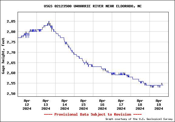
Current Estimated Status: Bridge ClearCurrent Water Height: 3.03 ft at HWY 109
Date/Time: 2025-05-09 23:00:00

over 5 ft - Bridge Flooded
between 4.5 - 5 ft - Use Caution
under 4.5 ft - Bridge Clear
USGS Source Page
Low Water Bridge Road runs from Coggins Mine Road in Eldorado to Ophir Road and is included in many different gravel cycling routes in the area. The low water Bridge is prone to flooding after big rain events and is hazardous to cross when over-topped. Find alternate routes when flooded.
Note: This is an estimate of the water level at the bridge location based on the downstream water level at HWY 109. If you see that the water level estimate is wrong, please snap a picture of the bridge, attach a date and time, and send to matt@therightgear.com. This will help make the estimate more accurate.
It's a safe bet that under 5 ft is ok to ride if the level is FALLING.
Because the level is being measured 8 miles downstream, there will be lag time between the bridge and the measurement location. The bridge will be flooded before the reading will trigger the warning indicator if the level is RISING.
If it's rising, be very cautious over 4.5 ft, and you'll need to account for the intensity of any local rains because the speed the river rises is very dependent on whether there is a massive storm downpour, or a long slow drizzle type of buildup.
Date/Time: 2025-05-09 23:00:00
over 5 ft - Bridge Flooded
between 4.5 - 5 ft - Use Caution
under 4.5 ft - Bridge Clear
USGS Source Page
Low Water Bridge Road runs from Coggins Mine Road in Eldorado to Ophir Road and is included in many different gravel cycling routes in the area. The low water Bridge is prone to flooding after big rain events and is hazardous to cross when over-topped. Find alternate routes when flooded.
Note: This is an estimate of the water level at the bridge location based on the downstream water level at HWY 109. If you see that the water level estimate is wrong, please snap a picture of the bridge, attach a date and time, and send to matt@therightgear.com. This will help make the estimate more accurate.
It's a safe bet that under 5 ft is ok to ride if the level is FALLING.
Because the level is being measured 8 miles downstream, there will be lag time between the bridge and the measurement location. The bridge will be flooded before the reading will trigger the warning indicator if the level is RISING.
If it's rising, be very cautious over 4.5 ft, and you'll need to account for the intensity of any local rains because the speed the river rises is very dependent on whether there is a massive storm downpour, or a long slow drizzle type of buildup.